
Corozal Town's history runs from the ancient Maya city of Chactemal through its founding in 1848 by refugees from Mexico's Caste War of Yucatán, a period as a British garrison and sugar town, and near-total destruction by Hurricane Janet in 1955. The planned, rebuilt town that followed is the Corozal you see today.
Understanding that story helps explain why Corozal feels the way it does: Spanish-speaking and Mestizo in culture, closely tied to Mexico, laid out in a neat grid of wide streets, and proud of its long past. Here is a short history, era by era.
Before Corozal: the Maya of Chactemal
People lived around Corozal Bay for thousands of years before the modern town existed. Burial pottery at Santa Rita, now inside the town's northwest edge, suggests a settlement may have formed there between 2000 and 1200 BCE, according to the summary of research on Santa Rita. The site reached its height in the Postclassic period, and historical evidence suggests it was probably the Maya city of Chactemal (also spelled Chetumal), capital of one of the Maya provinces the Spanish recorded when they arrived in the region.
Across the bay, Cerros was an earlier power. It grew from a small village around 400 BC into a ceremonial and trading centre, with major construction lasting until about AD 100. The National Institute of Culture and History describes it as part of a coastal trading network linking the New River to Chetumal Bay.
Rediscovering the past
Amateur archaeologist Thomas Gann explored Santa Rita in the early 1900s and recorded a Mixtec-influenced mural that no longer survives except in his copies. Later, the Corozal Postclassic Project led by Arlen and Diane Chase excavated the site between 1979 and 1985, uncovering burials and offerings that show Santa Rita's long reach in trade. When the modern town was built, stones from the old mounds were reused in construction, a reminder of how closely the two cities overlap.
1848: refugees from the Caste War found the town
The modern town was born out of war in neighbouring Yucatán. The Caste War, which began in 1847, pitted Maya rebels against the Yucatecan state. After a Mestizo stronghold at Bacalar was attacked, families fled south across the Rio Hondo into what was then British Honduras.
According to the history of Corozal Town, more than 10,000 refugees crossed the river between 1848 and 1856. The land around Corozal had been a private estate. Magistrate James Blake allowed the newcomers to settle, and they brought a new crop with them: sugar cane. The refugees raised Corozal's population to about 4,500 and gave the town its Mestizo, Spanish-speaking character. Other refugees settled nearby villages, including Sarteneja, settled largely in 1854.
A frontier and garrison town
The border remained unsettled for decades. The NICH historical marker at the old police station describes smuggling across the border and raids by Cruzob and Icaiche Maya groups. In the early 1870s, the colonial authorities built a police station staffed by Jamaican and Barbadian constables, along with a thick-walled jail. Fort Barlee was built in 1870, and its brick corner supports still surround the post office complex across from the central square.
Through the late 1800s and early 1900s, Corozal grew as a farming and market town. Sugar cane remained central to the district's economy, alongside fishing, small farms and cross-border trade. The town's mix of Yucatecan families, Maya communities, colonial officials and constables from Jamaica and Barbados shaped a culture that still blends Mestizo, Maya, Creole and British influences, and today both Spanish and English are widely spoken.
That mix also explains Corozal's long ties to Mexico. Families spread on both sides of the Rio Hondo, and crossing to what is now Chetumal for trade, shopping and visiting relatives has been part of life for generations.
Corozal timeline at a glance
| Date | Event |
|---|---|
| c. 400 BC to AD 100 | Cerros rises as a Late Preclassic centre on Corozal Bay |
| Postclassic period | Santa Rita, probably Chactemal, at its height |
| 1848 to 1856 | Caste War refugees settle Corozal; sugar cane introduced |
| 1870 | Fort Barlee built |
| 1952 | Corozal Town Hall built |
| 1953 | Manuel Villamor paints the Town Hall mural |
| 27 September 1955 | Hurricane Janet destroys most of the town |
| 1958 | Town gains a Mayor in place of a magistrate |
| 1979 to 1985 | Corozal Postclassic Project excavates Santa Rita |
| 1981 | Belize becomes independent |
| 1994 | Corozal Commercial Free Zone established |
1955: Hurricane Janet
The defining event in modern Corozal's history came on the night of September 27, 1955. Hurricane Janet, which at its peak was a Category 5 storm, struck the town late that evening. A local account published on Corozal.com describes only about 10 houses left standing, with the hospital, churches, schools and homes destroyed and crops almost entirely lost. Other sources estimate that around 90% of the town was destroyed.
The new concrete Town Hall, built in 1952 with money from the Baron Bliss Trust Fund, survived. About 300 residents took shelter inside during the storm, according to its historical marker.
Rebuilding a planned town
Recovery began with emergency relief from the Red Cross and donations from across the country, along with self-help efforts by residents. Temporary wooden barracks went up on the plaza. The Corozal.com account says the government bought land from William Schofield for $185,000, and a $3.5 million grant funded a planned township with electricity, water and sewerage. A new hospital was placed on the Santa Rita area, a new sea wall was built, and new buildings went up in concrete.
The rebuilt town was laid out with wider, better-drained streets. That grid, the seafront and the parks are the legacy of the post-Janet plan, and most of Corozal's buildings date from after the hurricane.
The Town Hall mural
In 1953, Corozal artist Manuel Villamor painted a mural inside the Town Hall depicting the town's history. He redesigned it in 1986, restored it in 2003, and completed a final restoration in 2012 at age 84. NICH now oversees its preservation. In 1958, following constitutional reform, Corozal's chief administrator changed from a magistrate to a Mayor, and the Town Hall became the seat of local government.
Modern Corozal
Belize gained independence in 1981, and Corozal grew steadily as the main town of the northern district. The Corozal Commercial Free Zone opened along the border in 1994 to attract trade and investment, and in January 2025 the government inaugurated a new access road to it. Corozal Town had an estimated population of about 13,500 in 2017 and sits about 84 miles north of Belize City and 9 miles from the Mexican border.
In recent decades, Corozal has also drawn retirees and newcomers from Canada and the United States, attracted by the bay, the lower cost of living and easy access to Chetumal. Our guide to the expat community in Corozal and our Corozal real estate guide cover life in the town today.
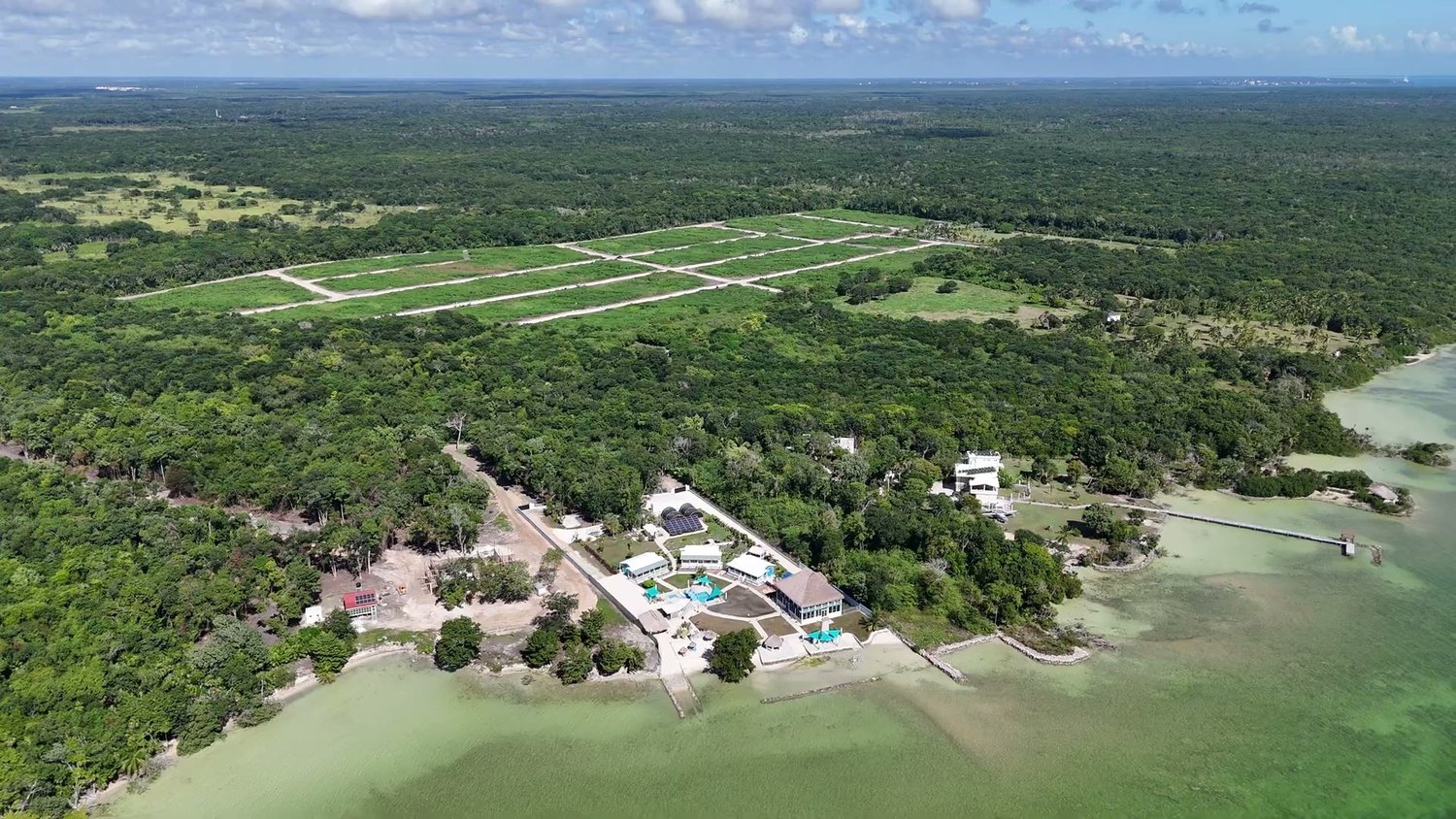
Coastal Vista Phase 2, on Consejo Road northeast of Corozal Town, is part of that newer chapter: a residential land subdivision where owners build their own homes near the same bay that has drawn settlers for thousands of years.
Frequently asked questions
When was Corozal Town founded?
The modern town dates from 1848, when refugees from the Caste War of Yucatán settled there.
Who were the first people in Corozal?
The Maya. Settlement at Santa Rita may go back to between 2000 and 1200 BCE, and the area later became the Maya city of Chactemal.
What happened to Corozal in 1955?
Hurricane Janet destroyed most of the town on the night of September 27, 1955. Corozal was rebuilt as a planned town afterward.
Where can I see Corozal's history today?
Visit the Santa Rita and Cerros Maya sites, the Town Hall mural and the NICH historical markers around the town centre. See our list of things to do in Corozal.
Become part of the next chapter
If Corozal's story makes you want to be part of its future, see which lots are open on the Coastal Vista lot map. For questions about the area or the community, write to us here.